Please note: The Academy will close at 3 pm on Thursday, April 18, for Big Bang Gala.
Science News
Monitoring California Hazards
December 18, 2013
by Molly Michelson
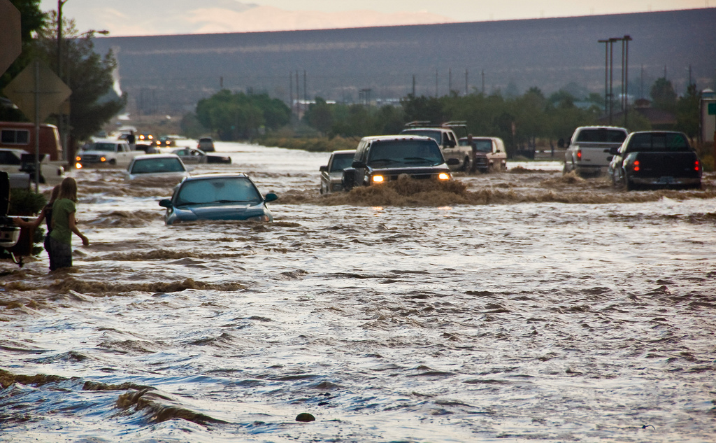
Yesterday we looked at a new method of monitoring the snowpack in California’s Sierra Nevada mountain range to help water resource managers better predict when water will be where.
Today we turn to another new monitoring system that measures water in our state, but this time in the form of large storms.
At the recent American Geophysical Union Meeting in San Francisco, scientists discussed enhancing existing monitoring stations with inexpensive sensors to get early warnings for large atmospheric river storms (and subsequent flooding), other extreme weather events, and seismic events like earthquakes and tsunamis.
Throughout southern California, there are 550 scientific-grade GPS stations that constantly receive signals from GPS satellites to determine their precise positions. A team of scientists from Scripps Institution of Oceanography, NASA, and NOAA determined that adding inexpensive sensors (less than $5,000 per station) could collect important data that could save lives. Last year they upgraded seventeen of these stations in high-risk areas for earthquakes, tsunamis, and flash floods.
The technology uses an optimal combination of GPS, accelerometer, and pressure and temperature data collected in real time. The results include accurate measurements of permanent motions (displacements) of ground stations and instruments deployed on structures, which form the basis for early detection of sustained damage, and measurements of precipitable water in the lower atmosphere, which informs short-term weather forecasting. The combination of sensors significantly improves current seismic and meteorological practices.
In other words, the stations will now be able to detect seismic activity and water vapor. The goal is to save lives during natural hazards such as earthquakes and storms and to mitigate damage to infrastructure such as hospitals, buildings, and bridges by making this real time data available to decision-makers and first responders.
The team put this new monitoring to test this past July during a summer monsoon event in southern California. The water vapor measured between sensors at several locations allowed the National Weather Service (part of NOAA) to issue accurate flash flood warnings.
For earthquakes, their system improves seismic monitoring by estimating ground motions and permanent displacements. The team can detect early P-waves (or primary waves) that forecast the damaging S-waves (or secondary waves), allowing for the opportunity to issue alerts for transportation and building authorities. Even a few seconds can save lives—whether it’s closing a bridge or shutting down a subway or elevator.
Image: sandy.redding/Flickr