Science News
Science Behind Haiti Quake
October 20, 2010
Nine months later and scientists are still sorting through the rubble of the Haiti Earthquake. Three new articles, published earlier this week in Nature Geoscience, attempt to clarify what exactly happened on January 12, 2010.
The devastating earthquake was unusual in some ways: scientists in the field found no evidence of surface rupture on the source Enriquillo-Plantain Garden fault, certain areas believed to be on solid ground were hit harder than expected, and the resulting tsunamis surprised geologists because the lateral motion of strike-slip faults rarely cause tsunamis.
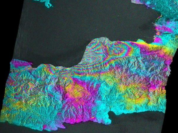
The first paper shifts the fault, literally. USGS and NASA/JPL scientists, working with others, used a combination of seismological observations, geologic field data, and satellite geodetic measurements to analyze the earthquake source. Their finding? The large earthquake resulted not from the Enriquillo fault, as previously believed, but from slip on multiple faults—primarily a previously unknown, subsurface fault.
In addition, because the earthquake did not involve slip near Earth’s surface, the study suggests that it did not release all of the strain that has built up on faults in the area over the past two centuries, meaning that future surface-rupturing earthquakes in this region are likely.
The second paper looks at the localized damage of the earthquake. After the major event, USGS scientist Susan Hough and her team set out seismographs that recorded aftershocks. Those recordings revealed that ground motions were amplified by the relatively young and soft rocks that underlie the valley in which Port-au-Prince lies. The strongest observed amplifications occurred along a narrow, steep foothill ridge in the city. That means that topography influenced the severity of aftershocks, too.
From the New York Times:
Seismologists know that local geology can also affect the severity of an earthquake… Now [this] new study finds that in addition to the underlying geology, the geometry of local surface features contributed to the earthquake’s intensity as well.
The study suggests that topographic effects should be considered when detailed hazard zone maps are made for other regions.
From OurAmazingPlanet:
Pinning down how topography amplifies an earthquake's energy — be it by steepness or width of a ridge, for example — will take longer, said the authors, but the initial findings could help guide the rebuilding effort.
Finally, the third paper finds that the tsunamis did not direct result directly from the quake, but most likely arose from underwater landslides triggered by the shaking. An article in National Geographic Daily News wonders what this could mean for our own earthquake-prone state. The good news is that, according to the article, “the risk of tsunamis… has already been included in California’s preparedness plans.”
The more we understand about the science of this terrible event, the better prepared we’ll be whenever and wherever it happens next.
Image credit: NASA/JPL/JAXA/METI