Science News
Insights from the Nepal Earthquake

The Gorkha earthquake in Nepal this past April was a devastating event, resulting in significant damages as well as large-scale geological changes. The shaking triggered landslides, with the highest peaks of the affected area losing 1.4 meters (4.6 feet) in elevation, and surfaces of the lower basins rising nearly 1.5 meters (4.9 feet). Two breaking studies recently announced discoveries about the magnitude 7.8 quake, lending new understanding to past seismic events in the Himalayas as well as possible projections going forward.
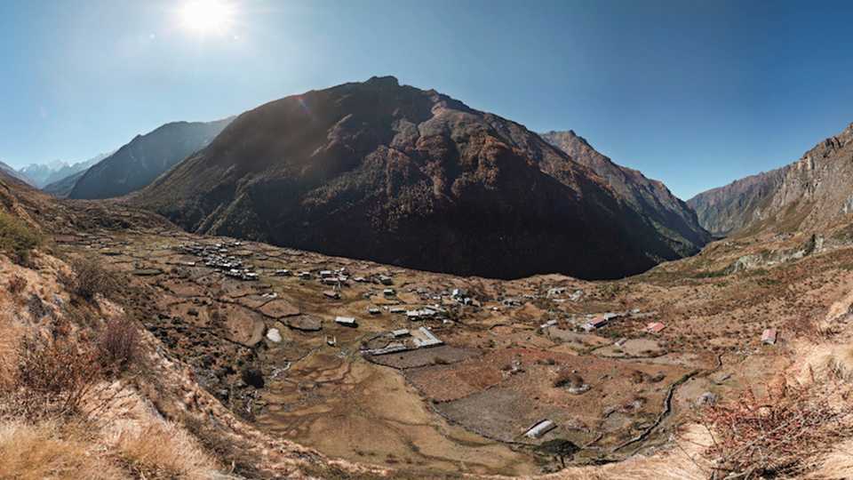
“There were some big surprises from the Nepal Gorkha earthquake,” said Jeffrey Kargel of the University of Arizona in a Wednesday session at the American Geophysical Union (AGU) meeting in San Francisco last week. While individual landslides were catastrophic, such as the one at Langtang Valley, overall incidence of related landslides was relatively low for an earthquake of its size. Kargel said this finding is possibly due to unusual rock strength in the area and relatively mild surface shaking compared to other regional events, but more research is needed.
Another surprise was that glacial lakes nearby sustained little damage. The Tsho Rolpa, a large brimful lake that garnered much concern, remained virtually untouched save for small cracks near its outlet. Kargel explained this likely was due to complex interactions between seismic waves and the rugged topography of surrounding bedrock, a lucky combination of the waves’ frequency and the local substrate.
While fewer landslides occurred than expected during the quake, landslides continued regularly for some time afterward, mostly at higher elevations. One area of substantial movement took place in the Marshyangdi River Valley of the Annapurna region, where eleven post-event landslides deposited sediment into the river to create a significant number of natural dams. One of the largest of these deposits contained nearly 373,000 cubic meters (more than 13 million cubic feet) of material—or the volume of 150 Olympic swimming pools of sediment! The blockages persisted for 26 days post-event, and caused great concern to downstream villages such as Lower Pisang, just two kilometers (1.2 miles) away. No significant rain or aftershocks followed, but the incident taught researchers much about landslide preparation and safety.
In working to understand more about the Gorkha event, another discovery was found right underfoot in Nepal’s second-largest city of Pokhara. Sediment examination revealed that the city is built on the residue of at least three medieval earthquakes, occurring around 1100, 1255, and 1344. The residue was traced to a highline basin in the Annapurna Massif, and covers an area roughly 148 square kilometers (57 square miles). Oliver Korup from the University of Potsdam remarked that this sediment data informed his team “like a book enabling us to validate the timing of large earthquakes, and even detect new events not yet found.”
While ancient sediments may tell us about past earthquakes, vastly collaborative methods were used to describe the recent seismic event at Gorkha. Four countries contributed advanced imagery from ten satellites after the earthquake, while open mapping efforts from nine countries yielded data on 4,312 landslide occurrences. Locals on the ground shared photos to help researchers concentrate activity, and NASA’s Dalia Kirshbaum described this collaboration as one of the broadest effective mapping efforts to date, saying, “The information sharing was tremendous, almost unprecedented.”
Do these findings point toward future risk of seismic activity in Nepal? The Gorkha quake did not release all accumulated stress on the main Himalayan thrust, and the Pokhara discovery shows that much larger earthquakes struck the region previously. Eric Fielding of the NASA Jet Propulsion Laboratory admitted a “clear danger of future earthquakes that could cause more extensive landslide damage” in the area, but when, where, and what magnitude remain open for debate.
Image: NASA